


Copyright © 2026 - Ozark Rides, All Rights Reserved


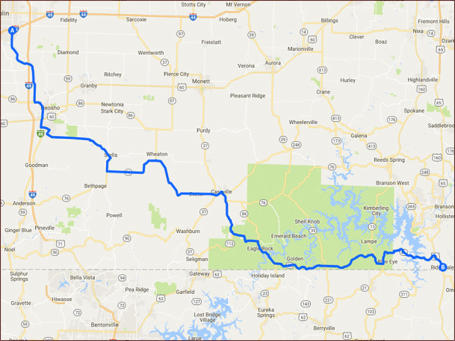
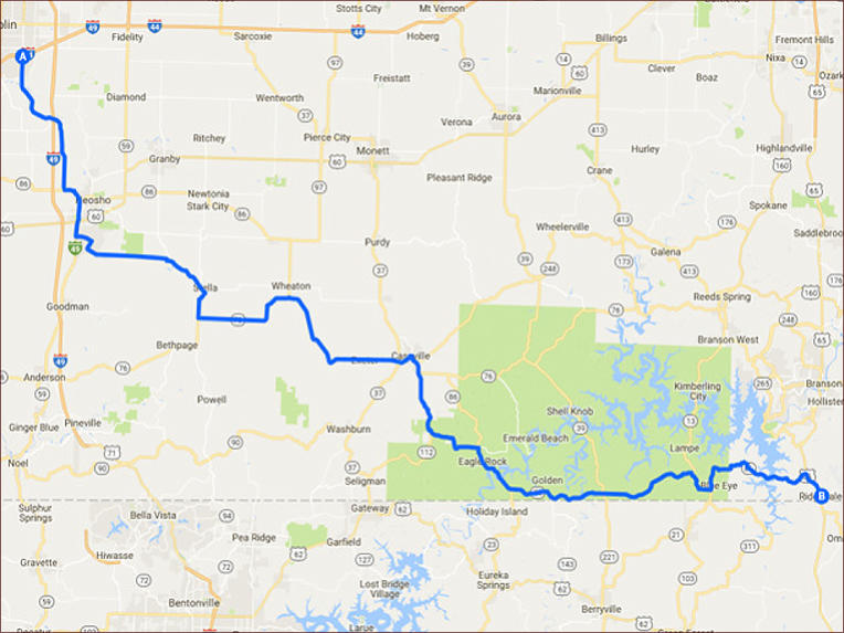
This 112 mile ride winds it’s way though the northwestern
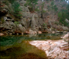
sections of the Ozarks and features the beauty of Table Rock
Lake, Eagle Rock and the beautiful Roaring River State Park.
Step by Step Directions:
From Joplin
Head southeast on I-44BL E/E 7th St toward E 7th St 1.27 mi *
Continue straight onto I-44BL E 1.53 mi * Turn right to merge
onto MO-249 S 1.87 mi * Continue onto I-49 15.0 mi * Take exit
24 for US-60 toward Neosho/Seneca 1,243 ft * Turn left onto
US-60 E 1.36 mi * Turn right onto I-49BL 1.25 mi * Turn left onto
W Lyon Dr 1.49 mi * Turn right onto Doniphan Dr 0.784 mi *
Doniphan Dr turns left and becomes State Hwy D/Austin Ave
Continue to follow State Hwy D 10.6 mi * Turn left onto State
Hwy A 0.867 mi * Turn right onto Ozark St 253 ft * Turn left at
the 1st cross street onto State Hwy A/Carter St Continue to
follow State Hwy A 7.78 mi * Continue straight onto W Hurlbut
St 0.501 mi * Continue onto State Hwy W 8.30 mi * Turn right
onto MO-37 S 2.51 mi * Turn left onto MO-37 BUS S 3.43 mi *
Turn left onto MO-112 S/MO-248 E/MO-76 E/MO-86 E Continue
to follow MO-112 S 7.29 mi * Turn left onto State Hwy F 5.22 mi
* Turn right onto MO-86 E 22.6 mi * Turn right onto MO-13
S/MO-86 E 2.84 mi * Turn left onto MO-86 E 11.5 mi * At the
traffic circle, take the 2nd exit and stay on MO-86 E 791 ft * Turn
right onto US-65 S 2.37 mi
Joplin to Ridgedale - 112 miles



MENU





![Close [x]](index_htm_files/close.png)


