
This 85 mile ride loops Taum Sauk Mountain (highest point in Missouri). When you take this route you might
try a short detour on CR CC and ride up to the Taum Sauk Mtn. peak. (To reach the summit there is a short
ride on a good quality but dirt road).


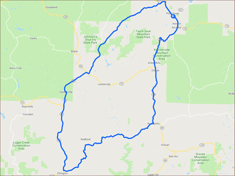
Ironton - Ellington Loop - 85 miles


SHARE WITH US
Copyright © 2026 - Ozark Rides, All Rights Reserved


![[x]](index_htm_files/close.png "Close")


Copyright © 2026 - Ozark Rides, All Rights Reserved


Ironton - Ellington Loop - 85 miles

This 85 mile ride loops Taum Sauk Mountain (highest point in
Missouri). When you take this route you might try a short detour
on CR CC and ride up to the Taum Sauk Mtn. peak. (To reach
the summit there is a short ride on a good quality but dirt road).


Step by Step Directions:
From Ironton
Head southeast on MO-21 S 11.5 mi Continue onto MO-49 S
10.1 mi Turn right onto 2nd St 0.251 mi Continue onto State
Hwy K 21.5 mi Turn right onto MO-21 N 19.8 mi Turn left onto
State Hwy N 18.9 mi Turn right onto MO-21 S 0.469 mi Turn
right to stay on MO-21 S 2.74 mi

MENU