
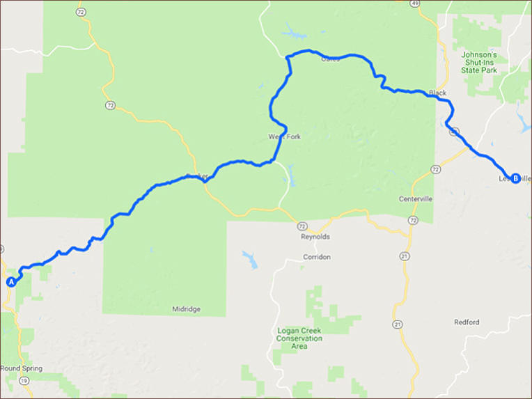
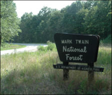
This 49 mile ride starts at the intersection of Hwy 19 and CR-A just northeast of the Sunklands Conservation
Area. As you progress northeast on CR-A you find yourself on a terrific two lane road that meanders through
the Mark Twin National Forest, providing you with the kind of untouched scenery that you can only find in a
National Forest setting.

Current River to Lesterville - 49 miles


SHARE WITH US
Copyright © 2026 - Ozark Rides, All Rights Reserved


![[x]](index_htm_files/close.png "Close")


Copyright © 2026 - Ozark Rides, All Rights Reserved


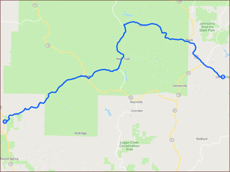
Current River to Lesterville - 49 miles

This 49 mile ride starts at the intersection of Hwy 19 and CR-A
just northeast of the Sunklands Conservation Area. As you
progress northeast on CR-A you find yourself on a terrific two
lane road that meanders through the Mark Twin National Forest,
providing you with the kind of untouched scenery that you can
only find in a National Forest setting.
Step by Step Directions:
From Hwy 19 & CR A
Head east on State Hwy A toward State Hwy CC 15.8 mi Turn
right onto MO-72 E 0.566 mi Turn left onto State Hwy KK 4.99
mi Continue straight 1,001 ft Turn left onto State Hwy KK 7.59
mi Turn right onto State Hwy J 11.6 mi Continue onto MO-49 S
4.68 mi Turn left onto MO-21 N/MO-49 S/MO-72 E 3.57 mi


MENU