
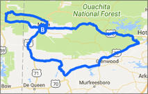
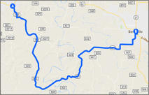
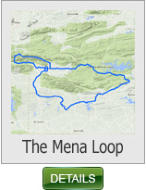
This 210 mile ride begins and ends in the town of Mena and follows the famous
Queen Wilhelmina Scenic Drive (AR 88). It also traverses through the
Ouachita National Forest.
The Mena Loop - 210 miles (Arkansas)
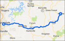
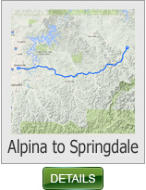
This 59 mile ride follows along the Ozark Plateau and offers plenty of long
sweeping curves.
Alpina to Springdale - 59 miles (Arkansas)
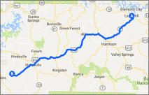
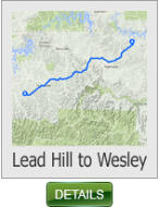
This 78 mile ride with it’s proximity to Harrison and the beautiful scenery
makes it a popular ride among the locals.
Lead Hill to Wesley - 78 miles (Arkansas)
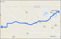
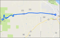
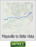
This 24 mile ride is located in the N.W. corner of the state and while it is a
relatively short ride, it does have some nice long sweepers, and is an ideal ride
for that “after work” stress reliever.
Maysville tp Bella Vista - 24 miles (Arkansas)
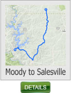
This 44 mile ride begins in the Missouri town of Moody, and continues south to
the Arkansas lakeside community of Salesville at the Southern most tip of
Norfork lake.
Moody to Salesville - 44 miles (Arkansas)
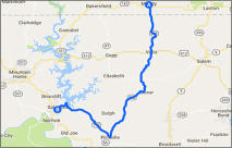
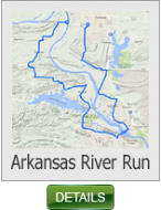
This 72 mile ride covers some of the prettiest scenery in Arkansas, covers a
variety of land types, some hilly and curvy through the climb out of the
Arkansas River Valley to the flatness and lushness of the Arkansas River Valley.
Arkansas River Run - 72 miles (Arkansas)
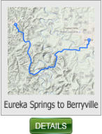
The views of the river are fantastic if you care to slow the pace down but the
curves begin immediately upon crossing the Kings River bridge and don't let
up for almost 10 miles as you climb up through the foothills of the Ozarks.
Eureka Springs to Berryville - 17 miles (Arkansas)
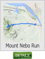
This short 6 mile ride includes 4 miles of rolling hills and then a very steep
climb. The mountain scenery is awesome. There are tons of deer on top, but
you'll ride so slow they are not a problem. Views of the valley below are
breath-taking.
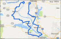
Mount Nebo Run - 6 miles (Arkansas)
This 94 mile ride takes in the beautiful scenery of the St. Francis National
Forest.
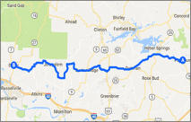
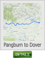
Pangburn to Dover - 94 miles (Arkansas)
Arkansas Ride Maps - Page 5


SHARE WITH US
Copyright © 2026 - Ozark Rides, All Rights Reserved


* Arkansas does not require riders to wear a DOT approved helmet


Copyright © 2026 - Ozark Rides, All Rights Reserved


210 Miles


94 Miles
59 Miles
78 Miles
24 Miles
44 Miles

72 Miles
17 Miles
6 Miles
Arkansas Ride Maps
Page 5


* Arkansas does not require riders to wear a DOT approved helmet


MENU